
BRETT FRENCH | bfrench@billingsgazette.com
Is your favorite fishing stream running the color of mud?
Heavy rains caused mudslides in some portions of Montana and Wyoming last week and more could be in store.
The West Yellowstone area seems to be at ground zero for much of the thunderstorm activity that could cause localized flash flooding, especially in areas with burn scars from wildland fires and low-lying regions.
“We have a pretty moist atmosphere,” explained meteorologist Lance VandenBoogart of the National Weather Service in Riverton, Wyoming. “We could be pushing record volumes by Thursday.”
The news comes as the 21 wildland fires burning in Oregon, eight in Washington and four in Idaho send smoke over Montana residents lowering the air quality from good to moderate.
Last week’s storms plagued a wide swath of the region.
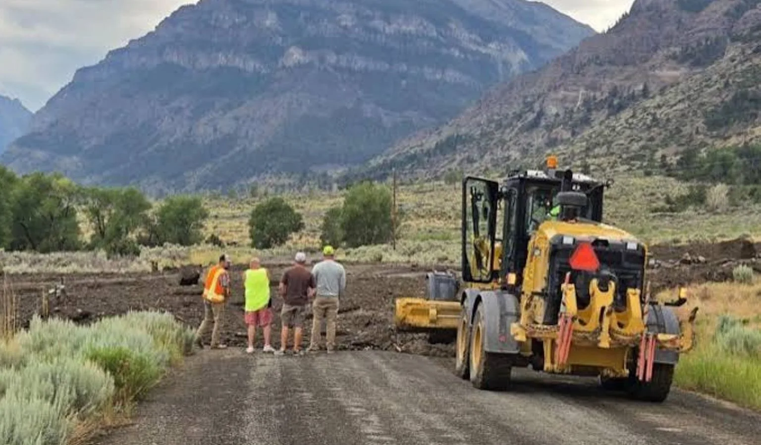
A bridge over Boulder Creek, in northwest Wyoming’s South Fork Shoshone River Canyon, was temporarily unusable last Wednesday, stranding residents and visitors, said Brian Edwards, Park County engineer.
“Crews worked for several hours well into the evening trying to keep rocks and debris away from the bridge without much luck due to the flow rate and intensity of the runoff event,” Edwards wrote in an email. “At that time water was coming over the road and above the bridge deck stranding several people that live on Hunter Creek Road. The next morning the runoff continued to be well above flood stage with rock, debris, and tree trunks completely plugging the main channel whereby no water was coming through the bridge but was bypassing around the bridge.”
Mudslides in the steep-walled canyon aren’t unusual because of its steep walls, he said, but residents told him they had never seen such a torrential downpour. Debris, rock and mud plugged the bridge over Boulder Creek.
“It just about took that bridge out,” Edwards said.
Park County Search and Rescue posted a drone video and photos shot by member George Dillman giving a bird’s-eye view of the Hunter Road devastation.
Park County dispatched an excavator and operator to clean out the creek channel by July 16.
Edwards said there were half a dozen other places along the county road where mud had swept across the roadway.
“In at least three locations, the mud slides completely engulfed the County Road measuring up to 100 yards wide and 6-8 feet deep,” Edwards wrote. “Cleanup efforts are continuing this week with several ditches and culverts along the roadway completely filled in.”
The slow-moving storm dropped 1 to 3 inches of rain in parts of northwest Wyoming, according to VandenBoogart.
A video posted by ice climber Aaron Mulkey on Facebook showed a waterfall of mud blasting off one mountainside known to local ice climbers as the Mean Green. He reported seeing “car size boulders” dislodged by the storm rolling down the mountain.
Another storm hit the region on Friday, dropping a half-inch to 1.5 inches of rain in the northeastern corner of Yellowstone National Park. The heavy rain activated sediment that turned the Yellowstone River a latte-looking brown over the weekend, shown in a photo on the Sweetwater Fly Shop’s Facebook page.
“There were several storms that developed all afternoon around northwestern Wyoming, said meteorologist Joshua Rowe at the Riverton office.
A mudslide also swept across a road in Montana’s Beaverhead County, blocking the Big Sheep Creek Canyon road southwest of Dell and damming the stream, according to a Facebook post by University of Montana Western geology professor Rob Thomas.
“It dumped over a meter-thick pile of rock debris over the road, blocked the creek and created a lake,” Thomas wrote. “When large quantities of water rapidly fall on the land, it cannot sink into the ground and floods across the surface. The rock debris can turn into a fast-moving slurry of water, mud and rock called a debris flow that is so viscous (thick) it can transport huge rocks and destroy homes.”
Hail up to an inch in diameter and rain pelted the nearby historic mining community of Argenta on Wednesday, according to meteorologist Matt Ludwig, creating one of the more extreme storms seen in recent years in that area.
Tessa Stetzer, a meteorologist with the Billings office of the National Weather Service, said rain will fall mostly over the mountains on Tuesday, increasing by Wednesday. Last week’s storms brought about .86 inches of rain to the Billings area, she said.
“When we do get monsoonal storms, it’s not unusual to see heavy rains,” Stetzer said.
Montana's outdoor week, in your inbox at 7am Friday.