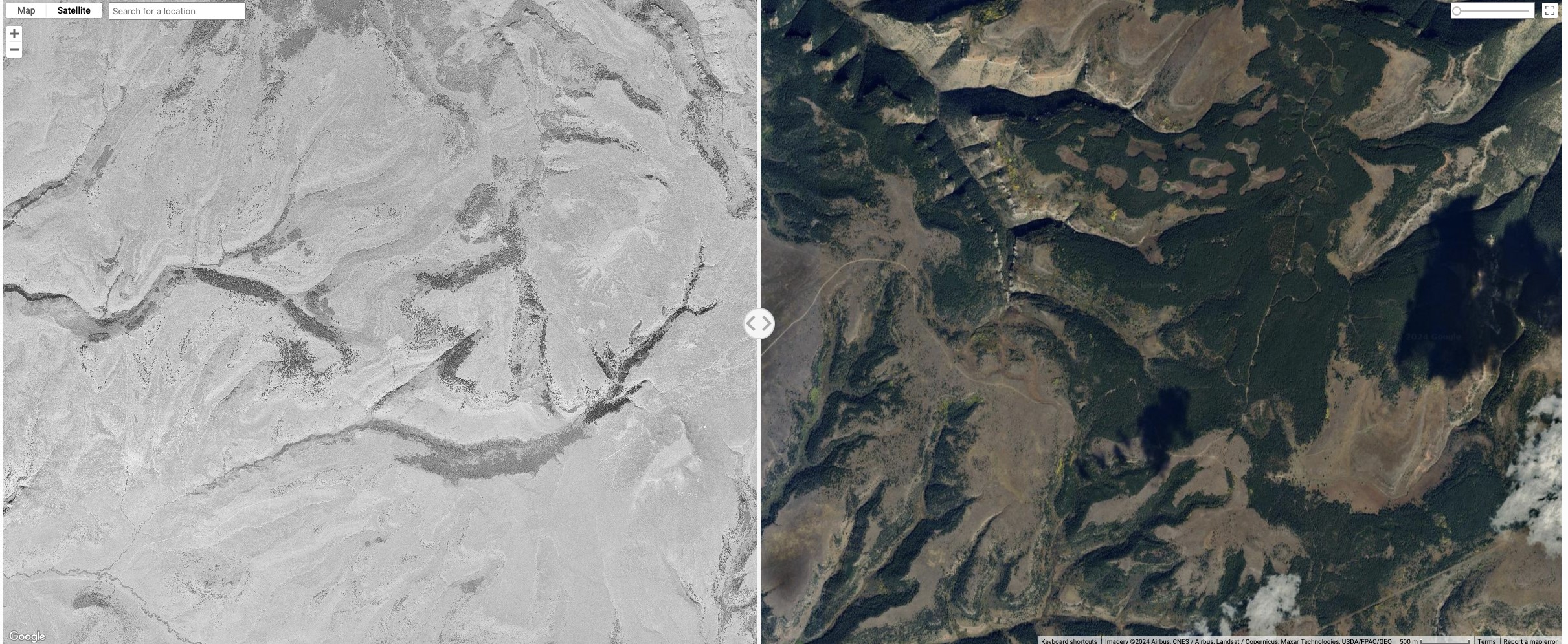
Ever wonder what your favorite hunting spot looked like in the 1950s? Or maybe you are curious about how development has encroached on your longtime fishing hole. Scientists at the University of Montana have created a new program called Landscape Explorer that allows anyone to view areas of the state, and across the West. The program provides aerial photos from the 1950s on the left side of the viewing window, with the right side showing modern Google Earth views. The technology was created to document how landscapes have changed, especially sagebrush and grassland habitats. By comparing the two views, researchers, conservationists and landowners can understand how trees like Douglas-fir and juniper have moved into grasslands. Such encroachment reduces habitat for sagebrush-dependent wildlife like sage grouse and mule deer. To learn more about the program, check out my story at https://billingsgazette.com/outdoors/university-of-montana-landscape-explorer-conservation-grasslands/article_83c59914-ec7c-11ee-a42d-1fcc665172cd.html.
Written by Brett French | Outdoors Editor for Billings Gazette